What a beautiful day today was! I stopped into the local Tim Horton's in Williams Lake around 7:00 this morning for some coffee and road fuel, and there were about 10-12 young people wearing firefighting gear. They were in the area to fight the fires that started this week, but according to them, the most they can hope to do is to contain the blazes until they go out on their own. There is an infestation of a pine beetle in central British Columbia that is killing virtually all the 80+ year-old mature trees, so there is a lot of standing, dead wood in the whole central portion of the province.
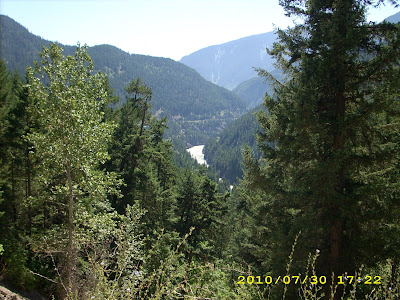
Headed down Hwy 97 toward Cache Creek to pick up Hwy 1, the Trans-Canada Highway. This should give you some idea of what the terrain is like just south of Williams Lake and also some idea of how thick the smoke was in the area:
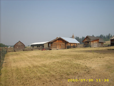
I headed on down the road to the 108-Mile Ranch, about 50 miles south of Williams Lake. This is a frontier settlement dating from the 1880's and 1890's and was pretty interesting to see:
The name "108 Mile Ranch" refers to the distance from the start of the Cariboo Road, which was built in 1860 from Yale, BC to Barkerville, BC. (History lesson there...)
At 70-Mile House (you guessed it...38 miles south of 108-Mile Ranch) is The Chasm Provincial Park, which was sort of a miniature Grand Canyon:
This was about the best shot I could get of the canyon itself. Can you guess what the haze is?
I would guess the canyon is about 300 feet deep and 1/4 mile wide.
At Cache Creek, we picked up Hwy 1, the Trans-Canada Hiway that stretches all across the southern part of Canada. You can see how arid the land is just south of Cache Creek. The river in the picture is the North Thompson River, which runs into the Fraser River further south:
South of Spence's Bridge, we started through the Fraser River Canyon, which was quite striking. This first picture was taken at Jackass Mountain, about 20 miles south of Spence's Bridge:
Just south of Boston Bar is the Hell's Gate Airtram, which goes from the roadway down into the canyon:
And one last shot of the Fraser River Canyon down close to Yale, BC:
As you can see from the last four pictures, the terrain has become more densely forested and more lush the further south we came. About 15 miles north of Chilliwack lies Bridal Veil Falls Provincial Park, the last tourist stop for the day. The falls were simply beautiful:
Also, as you can see, the area around the falls is like a tropical rain forest.
That's it for today. Tomorrow it's across the border at Abbotstown, BC and down to Raymond, WA for the night. Miles today: 300. Total: 8,082.


